")
your data ground
your territorial data
with existant business
tools
THE ADVANTAGES OF OUR SOLUTION
Personalize your data collecting process
Centralize your observation collected on ground
Identify the observations that require an intervention
Personalize your PDF exports
Visualize your data trough personalized dashboard to optimize your management

Contributes to your Artificial Intelligence approach
Watch the SmartVigie teaser
ACTIVITY
MOBILITY
Transports
Heritage
Public space
Environment
Natural risk
THE STAKEHOLDERS

Operators of urban and interurban transport networks

Airport and port operators

Regional and local authority

Real estate (shopping centres etc...)
How does it work?
Analysis and integration of customer data
(mapping, collection process, interoperability with existing tools)
Structured data ground collection
(pictogram library, geolocation, photos)
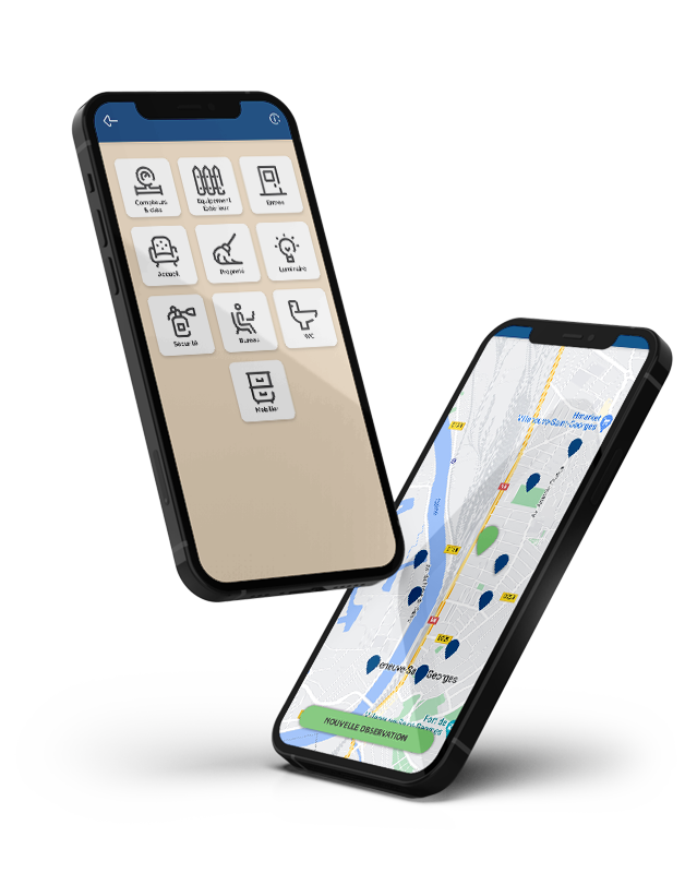
Identify the observations that require an intervention
(automatic prioritization)
Ensure continuity, reliability and security of your heritage
through personalized dashboards
The SmartVigie platform
The SmartVigie solution is developped in Saas mode. The Saas mode allows to diagnostic and map the status of the infrastructures and buildings of your heritage in real time.
The operator chooses the type of information he wants to transmit. The operator’s agents report their report form via the app. The back-office platform optimizes information, aggregates complete data thanks to a ranking by its degree of urgency.
The users can easily interact with their teams to solve events efficiently: launch of interventions and works, etc.


Their SmartVigie experience

SMIAGE
Watercourse maintenance
Collection, by the agents of the Syndicate, of data related to climatic events affecting rivers, streams, etc.

Ostend Airport
Handrail management
Feedback by airport employees of reports of defects on equipment
Lyon's primaries schools
School Maintenance
Escalation by municipal officials of requests for repairs, minor works and maintenance


Mentions légales © Ubiplace